
The 3D map that transforms every fair into an experience.

Contact us

Mapdo is developed by Tredo, in collaboration with Search On Media Group, to bring 3D innovation to physical events.
The problem? Orientation, and more. People walking between the stands without knowing where to go. They waste time, opportunities, and meetings.

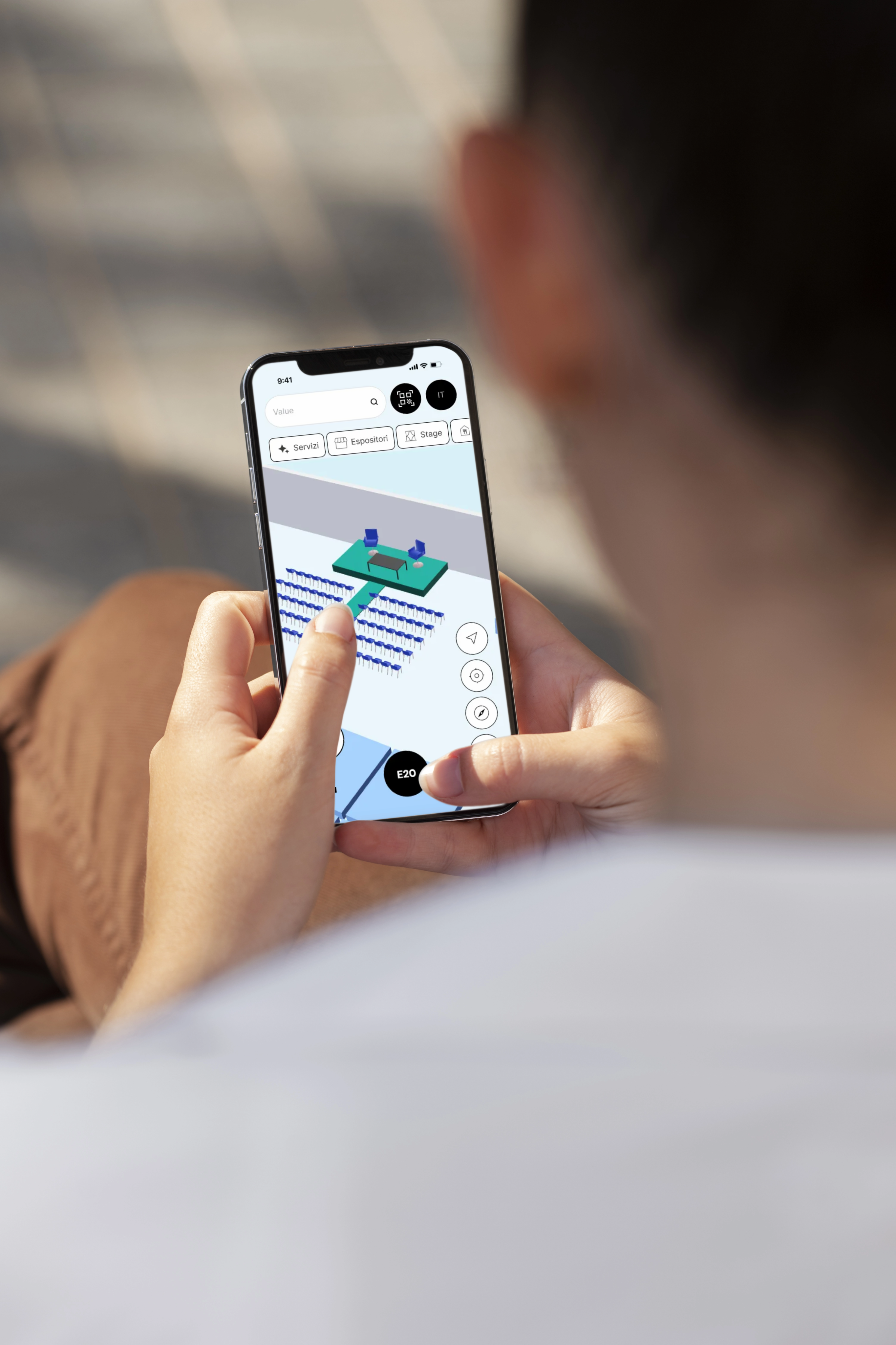
The solution is Mapdo
We start with the technical layout of the event and transform it into a clear and navigable 3D map.
Visitors can navigate independently, each stand can stand out with personalised content, and all updates are just a click away.
Book a demo
Main features
You don’t need to download any app!
The best features of the 3D map are at your website's fingertips.
Feature
Smart search
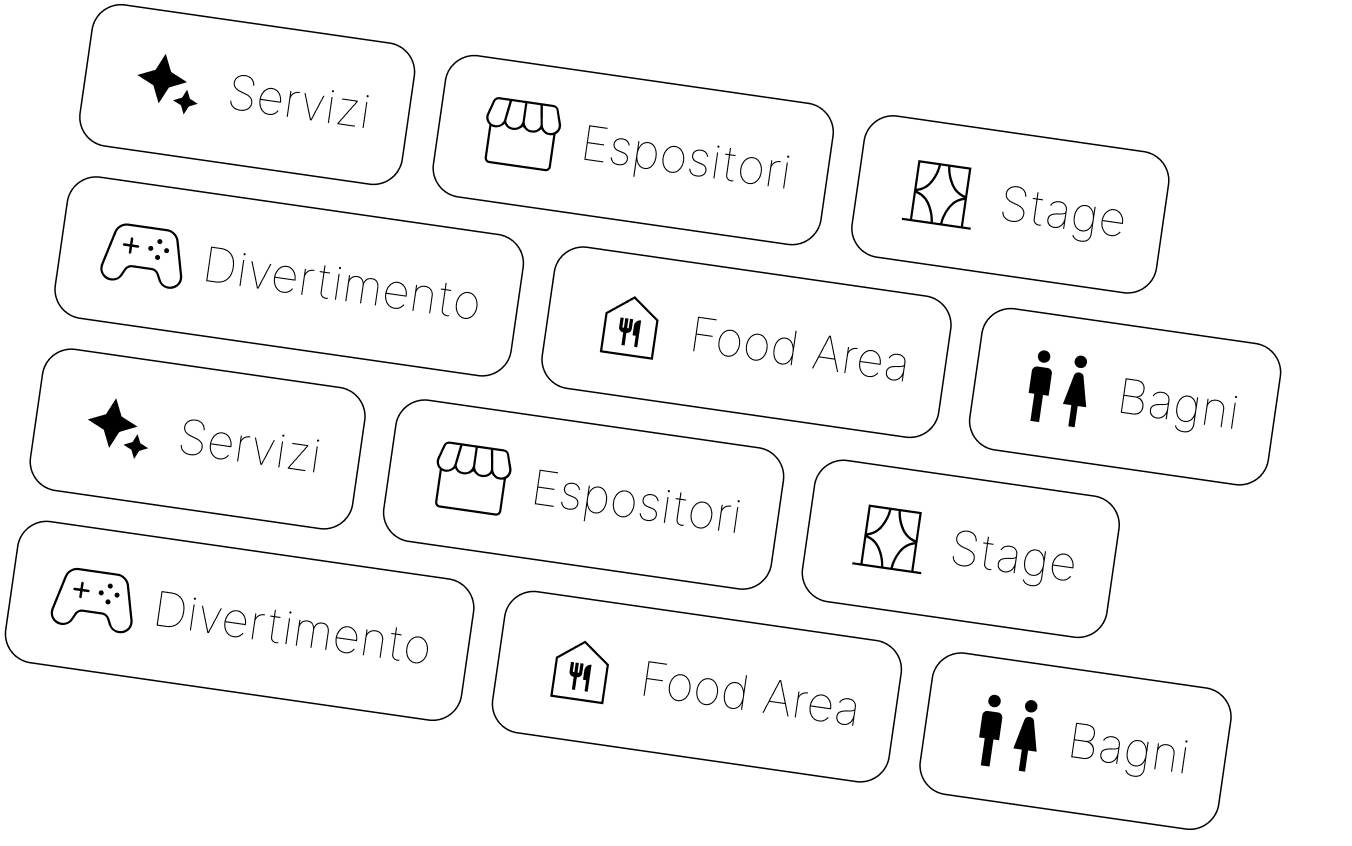
Find exactly what you’re looking for: stands, events, brands, or services.
With thematic filters, every visitor enjoys a smooth and personalised experience.
Feature
Always updated stands and events
Every change to the map is instantaneous: you can change locations, update stand details, and add live events.
Everything syncs in real-time, without the need for manual intervention.
Feature
Informative QR Codes
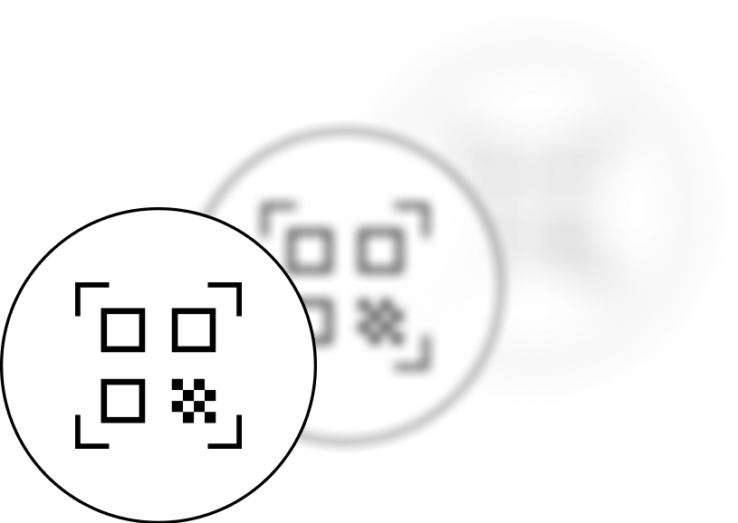
QR codes that interact directly with the 3D map: they can be used to access the content of a stand, as well as to activate the "Where am I?" feature and navigate in real-time within the event.
Feature
Multilingual
Paths for everyone, support for multiple languages, voice directions.
Inclusivity is part of the project.

Integration without complications
Connect your event to the digital world in just a few steps.
Mapdo easily integrates with Ibrida, our native platform, or via stand-alone APIs for completely customised solutions.
Every booth, content, or update is immediately available on the 3D map, which is always up-to-date and accessible from any device.
Book a demo
our options
Choose your integration

Stand-alone solution
Mapdo Stand-alone
Mapdo also adapts to external systems thanks to its API integration.
A flexible option for those who want an interactive 3D map but already have their own infrastructure.
hybrid.io App
All-inclusive: Mapdo + Ibrida
Mapdo works in synergy with Hybrid, our native event management platform.
Every stand, content, or update is immediately available on the 3D Map.
Discover hybrid.io

For organizers
A simpler, more flexible management system that is updated in real-time. Everything you need to provide a flawless experience, without complications:
- From the floor plan to the 3D map
- Direct creation via CAD
- Native integration through Hybrid
- Dashboard for instant updates (coming soon)
- Detailed statistics on interactions, clicks, and paths (coming soon)
For visitors
An intuitive, accessible, and interactive experience. Each participant can easily navigate and not miss anything:
- Seamless exploration: zoom, rotation, thematic layers
- All information within the map.
- QR Code and geolocated map
- Accessible routes, stands, and favourite content (coming soon)
- Smart search (coming soon)
Events held
We make future 2025

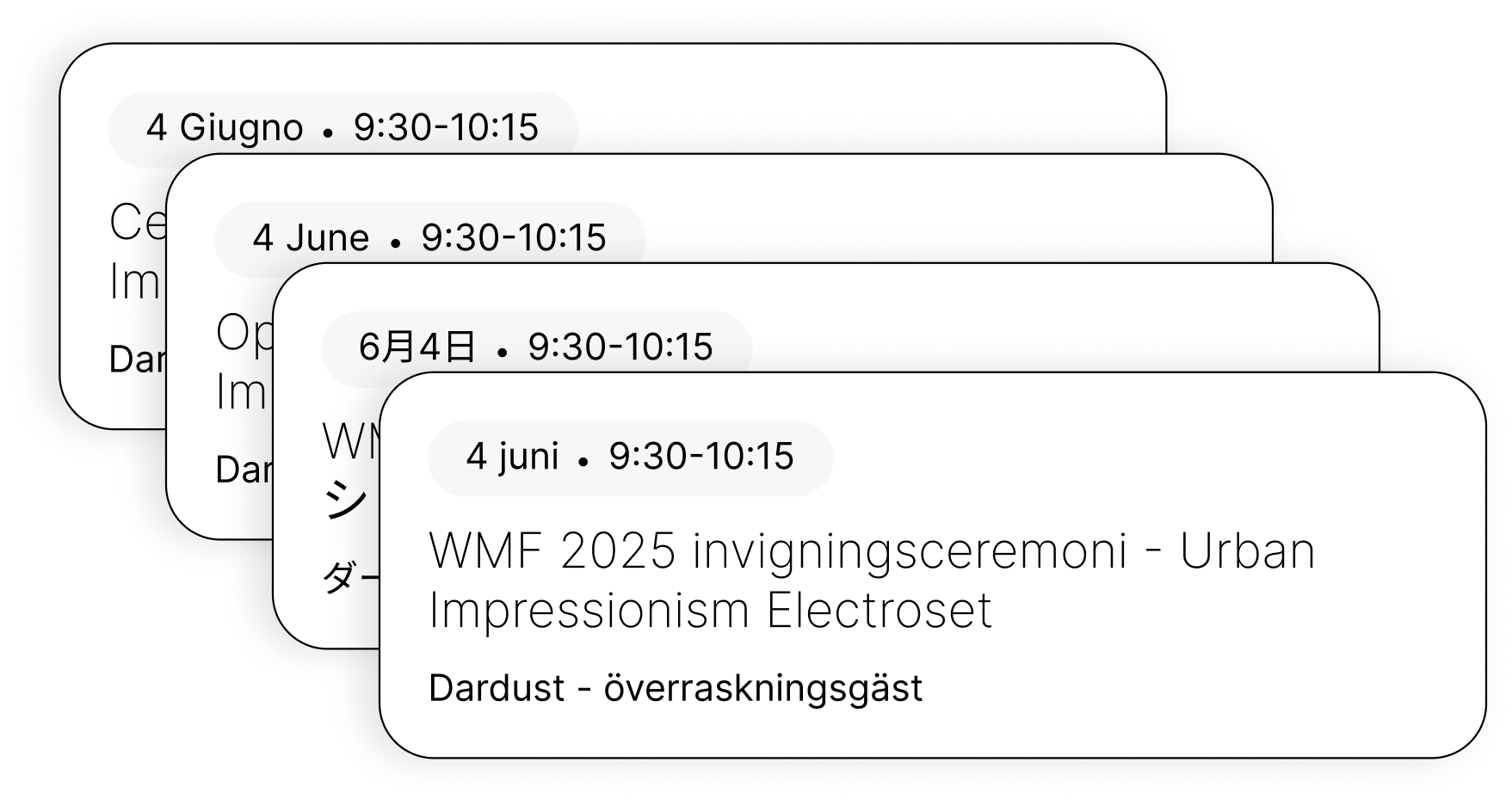
Mapdo led the WMF 2025 with a navigable 3D map, accessible from any device and updated in real-time. Thousands of participants easily oriented, organizers always in control.
Want to discover the 3D experience of the WMF?

View the map
All the mapdo functions
The functions that make your 3D map a powerful and user-friendly tool for both organisers and visitors.

Easy orientation, inside and out
3D map always geolocated within the event spaces. Search by name, category, or code.

Stands and events always up to date
Every change to the map is instantaneous: you can change locations, update stand sheets, and add live events. Everything syncs in real-time, without the need for manual intervention.

Informative QR Codes
QR codes that interact directly with the 3D map: they can be used to access the contents of a stand, as well as to activate the 'Where am I?' function and navigate in real-time within the event.

Multilevel 3D view
Fair, pavilion or stand? Adaptive zoom and rotation. 3D content such as stages and sponsor areas.

Generated by AutoCAD
Just your CAD file to get started. We read every layer and transform it into a dynamic visual experience linked to your data.

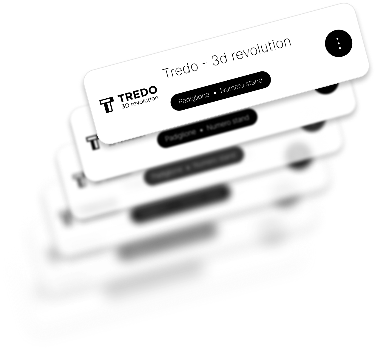
Premium visibility
Highlight your partners: logos, interactive content, and customised 3D spaces directly on the map.

Multilingual
Paths for everyone, support for multiple languages. Inclusivity is part of the project.

Smart search
Find exactly what you're looking for: stands, events, brands, or services. Thanks to thematic filters, every visitor experiences a smooth and personalised journey.

Gamification
Engage the audience with interactive elements: hidden easter eggs, prize challenges, mini-games. The map becomes an experiential space, perfect for increasing dwell time and event memorability.
Coming soon
Navigazione indoor
Ability to create a personal profile to: • Save favourite stands and events • Build a personalised route • Receive targeted updates
Coming soon
App
Advanced analytics
Monitor everything happening on the map: • Interactions with stands • Clicks on content • Most followed routes • Areas of greatest interest
Coming soon
App
Beacon
It will be possible to enable navigation with advanced precision, thanks to integration with Bluetooth beacons. An even more intuitive way to guide visitors at your event.
Coming soon
App
Dashboard personale
Within the 3D map, visitors to the event can follow a route with directions and easily reach the desired stand or scheduled event.
Coming soon
App
Offline mode
Even without a connection, the map works. The 3D map can be accessed in offline mode, allowing every visitor to continue navigating, exploring stands, and accessing saved content, even in the absence of a network or in areas with weak signal.
How does it work
Know where to go without wasting time, opportunities, or meetings.

Let's start with your map
We support complex CAD files: splines, arcs, multi-level. No limits.
1

Allestiamo il tuo evento in 3D
2
Stands, sponsors, content, schedules: all connected to the map through Ibrida or with a dedicated integration via API.

Your map is online
Available on mobile, desktop, or kiosks, always accessible.
3
Who worked on the project
Frequently Asked Questions
What is Mapdo?
Mapdo is a Tredo service in partnership with Search On Media Group, which develops 3D maps for events. We transform the technical layout of an event into a clear, navigable, and real-time updated digital experience.

Can I customize the appearance of the map?
Yes, each map is fully customizable. You can adjust colors, logos, visible layers, and interactive content to best represent your event and enhance exhibitors with unique 3D elements.
Can I include the event schedule on the map?
Yes, the map includes a section dedicated to the schedule. Each event is geolocated: you can view times, descriptions, and locations by clicking directly on the corresponding area or stage. Everything is updated in real-time.
Does Mapdo work on my website too?
Absolutely yes. Mapdo is designed to be integrated directly into your site, without needing to download an app. Visitors can access the map from any device by opening a web page.
And on my App?
Sure, it is possible to integrate the service directly into your App. Don’t have an App? Mapdo could become your app and unlock all the "App Features".
What are the "App Features"?
These are advanced features, available only by using your application integrated with Mapdo technology.
What does native integration with Ibrida mean?
It means you can leverage all of Ibrida's features for managing your events, including managing exhibitor content and the schedule.
What is meant by stand-alone integration?
If you already have an event management system, there is no need to adopt Ibrida. You can integrate your management system via API. This means you can connect your management system to any platform while keeping the map synchronized and tailored.
What is the "Premium Visibility" feature?
It means having full control over the map's content, thus increasing the visibility of certain exhibitors or sponsors of the event.
Transform your event into a 3D map now!
Contact us to try a free demo and discover what Mapdo can do for your event.
No obligation, just a 3D experience to try.


Request a demo


Cosmo S.r.l.s.
P.Iva/C.F. IT12462640017

+39 011 4275 805

hello@tredo.it

Via San Secondo, 62
10128 Turin (TO) Italy
Solutions
What is it?
Who needs it?
How it works
A service of
Tredo - più vero del reale
In collaboration with
Search On Media Group
© 2025 Cosmo. All rights reserved
Privacy Policy
Cookie Policy


Book a demo
IT
I
EN
The 3D map that transforms every fair into an experience.
Contact us
Mapdo is developed by Tredo, in collaboration with Search On Media Group, to bring 3D innovation to physical events.
The problem? Orientation, and more. People walking between the stands without knowing where to go. They waste time, opportunities, and meetings.
The solution is Mapdo
We start with the technical layout of the event and transform it into a clear and navigable 3D map.
Visitors can navigate independently, each stand can stand out with personalised content, and all updates are just a click away.
Book a demo
Main features
You don’t need to download any app!
The best features of the 3D map are at your website's fingertips.
Feature
Smart search
Find exactly what you’re looking for: stands, events, brands, or services.
With thematic filters, every visitor enjoys a smooth and personalised experience.
Feature
Always updated stands and events
Every change to the map is instantaneous: you can change locations, update stand details, and add live events.
Everything syncs in real-time, without the need for manual intervention.
Feature
Informative QR Codes
QR codes that interact directly with the 3D map: they can be used to access the content of a stand, as well as to activate the "Where am I?" feature and navigate in real-time within the event.
Feature
Multilingual
Paths for everyone, support for multiple languages, voice directions.
Inclusivity is part of the project.
Integration without complications
Connect your event to the digital world in just a few steps.
Mapdo easily integrates with Ibrida, our native platform, or via stand-alone APIs for completely customised solutions.
Every booth, content, or update is immediately available on the 3D map, which is always up-to-date and accessible from any device.
Book a demo
our options
Choose your integration
Stand-alone solution
Mapdo Stand-alone
Mapdo also adapts to external systems thanks to its API integration.
A flexible option for those who want an interactive 3D map but already have their own infrastructure.
hybrid.io App
All-inclusive: Mapdo + Ibrida
Mapdo works in synergy with Hybrid, our native event management platform.
Every stand, content, or update is immediately available on the 3D Map.
Discover hybrid.io
For organizers
A simpler, more flexible management system that is updated in real-time. Everything you need to provide a flawless experience, without complications:
- From the floor plan to the 3D map
- Direct creation via CAD
- Native integration through Hybrid
- Dashboard for instant updates (coming soon)
- Detailed statistics on interactions, clicks, and paths (coming soon)
For visitors
An intuitive, accessible, and interactive experience. Each participant can easily navigate and not miss anything:
- Seamless exploration: zoom, rotation, thematic layers
- All information within the map.
- QR Code and geolocated map
- Accessible routes, stands, and favourite content (coming soon)
- Smart search (coming soon)
Events held
We make future 2025
Mapdo led the WMF 2025 with a navigable 3D map, accessible from any device and updated in real-time. Thousands of participants easily oriented, organizers always in control.
Want to discover the 3D experience of the WMF?
View the map
All the mapdo functions
The functions that make your 3D map a powerful and user-friendly tool for both organisers and visitors.
Easy orientation, inside and out
3D map always geolocated within the event spaces. Search by name, category, or code.
Stands and events always up to date
Every change to the map is instantaneous: you can change locations, update stand sheets, and add live events. Everything syncs in real-time, without the need for manual intervention.

Informative QR Codes
QR codes that interact directly with the 3D map: they can be used to access the contents of a stand, as well as to activate the 'Where am I?' function and navigate in real-time within the event.

Multilevel 3D view
Fair, pavilion, or stand? Adaptive zoom and rotation. 3D content such as stages and sponsor areas.
Generated by AutoCAD
Just your CAD file to get started. We read every layer and transform it into a dynamic visual experience linked to your data.

Premium visibility
Highlight your partners: logos, interactive content, and customised 3D spaces directly on the map.

Multilingual
Paths for everyone, support for multiple languages. Inclusivity is part of the project.

Smart search
Find exactly what you're looking for: stands, events, brands, or services. Thanks to thematic filters, every visitor experiences a smooth and personalised journey.
Gamification
Engage the audience with interactive elements: hidden easter eggs, prize challenges, mini-games. The map becomes an experiential space, perfect for increasing dwell time and event memorability.
Coming soon
Navigazione indoor
Ability to create a personal profile to: • Save favourite stands and events • Build a personalised route • Receive targeted updates
Coming soon
App
Advanced analytics
Monitor everything happening on the map: • Interactions with stands • Clicks on content • Most followed routes • Areas of greatest interest
Coming soon
App
Beacon
It will be possible to enable navigation with advanced precision, thanks to integration with Bluetooth beacons. An even more intuitive way to guide visitors at your event.
Coming soon
App
Dashboard personale
Within the 3D map, visitors to the event can follow a route with directions and easily reach the desired stand or scheduled event.
Coming soon
App
Offline mode
Even without a connection, the map works. The 3D map can be accessed in offline mode, allowing every visitor to continue navigating, exploring stands, and accessing saved content, even in the absence of a network or in areas with weak signal.
How does it work
Know where to go without wasting time, opportunities, or meetings.
Let's start with your map
We support complex CAD files: splines, arcs, multi-level. No limits.
1
2
We set up your event in 3D
Stands, sponsors, content, schedules: all connected to the map through Ibrida or with a dedicated integration via API.
Your map is online
Available on mobile, desktop, or kiosks, always accessible.
3
Who worked on the project
FAQ
What is Mapdo?
Mapdo is a Tredo service in partnership with Search On Media Group, which develops 3D maps for events. We transform the technical layout of an event into a clear, navigable, and real-time updated digital experience.

Can I customize the appearance of the map?
Yes, each map is fully customizable. You can adjust colors, logos, visible layers, and interactive content to best represent your event and enhance exhibitors with unique 3D elements.
Can I include the event schedule on the map?
Yes, the map includes a section dedicated to the schedule. Each event is geolocated: you can view times, descriptions, and locations by clicking directly on the corresponding area or stage. Everything is updated in real-time.
Does Mapdo work on my website too?
Absolutely yes. Mapdo is designed to be integrated directly into your site, without needing to download an app. Visitors can access the map from any device by opening a web page.
And on my App?
Sure, it is possible to integrate the service directly into your App. Don’t have an App? Mapdo could become your app and unlock all the "App Features".
What are the "App Features"?
These are advanced features, available only by using your application integrated with Mapdo technology.
What does native integration with Ibrida mean?
It means you can leverage all of Ibrida's features for managing your events, including managing exhibitor content and the schedule.
What is meant by stand-alone integration?
If you already have an event management system, there is no need to adopt Ibrida. You can integrate your management system via API. This means you can connect your management system to any platform while keeping the map synchronized and tailored.
What is the "Premium Visibility" feature?
It means having full control over the map's content, thus increasing the visibility of certain exhibitors or sponsors of the event.
Transform your event into a 3D map now!
Contact us to try a free demo and discover what Mapdo can do for your event.
No obligation, just a 3D experience to try.
Request a demo


Cosmo S.r.l.s.
P.Iva/C.F. IT12462640017
+39 011 4275 805
hello@tredo.it
Via San Secondo, 62
10128 Turin (TO) Italy
Solutions
What is it?
Who needs it?
How it works
A service of
Tredo - più vero del reale
In collaboration with
Search On Media Group
© 2025 Cosmo. All rights reserved
Privacy Policy
Cookie Policy

Book a demo
IT
I
EN
The 3D map that transforms every fair into an experience.
Contact us

Mapdo is developed by Tredo, in collaboration with Search On Media Group, to bring 3D innovation to physical events.
The problem? Orientation, and more. People walking between the stands without knowing where to go. They waste time, opportunities, and meetings.
The solution is Mapdo
For organisers
For visitors
For sponsors
We start with the technical layout of the event and transform it into a clear and navigable 3D map.
Visitors can navigate independently, each stand can stand out with personalised content, and all updates are just a click away.
Book a demo
Main features
You don’t need to download any app!
The best features of the 3D map are at your website's fingertips.
Feature
Smart search
Find exactly what you’re looking for: stands, events, brands, or services.
With thematic filters, every visitor enjoys a smooth and personalized experience.
Feature
Always updated stands and events
Every change to the map is instantaneous: you can change locations, update stand details, and add live events.
Everything syncs in real-time, without the need for manual intervention.
Feature
Informative QR Codes
QR codes that interact directly with the 3D map: they can be used to access the content of a stand, as well as to activate the "Where am I?" feature and navigate in real-time within the event.
Feature
Multilingual
Paths for everyone, support for multiple languages, voice directions.
Inclusivity is part of the project.
Integration without complications
Connect your event to the digital world in just a few steps.
Mapdo easily integrates with Ibrida, our native platform, or via stand-alone APIs for completely customised solutions.
Every booth, content, or update is immediately available on the 3D map, which is always up-to-date and accessible from any device.
Book a demo
our options
Choose your integration
Stand-alone solution
Mapdo Stand-alone
Mapdo also adapts to external systems thanks to its API integration.
A flexible option for those who want an interactive 3D map but already have their own infrastructure.
hybrid.io App
All-inclusive: Mapdo + Hybrid
Mapdo works in synergy with Hybrid, our native event management platform.
Every stand, content, or update is immediately available on the 3D Map.
Discover hybrid.io
For organizers
A simpler, more flexible management system that is updated in real time. Everything you need to provide a flawless experience, without complications:
- From the floor plan to the 3D map
- Direct creation via CAD
- Native integration through Hybrid
- Dashboard for instant updates (coming soon)
- Detailed statistics on interactions, clicks, and paths (coming soon)
For visitors
An intuitive, accessible, and interactive experience. Each participant can easily navigate and not miss anything:
- Seamless exploration: zoom, rotation, thematic layers
- All information within the map.
- QR Code and geolocated map
- Accessible routes, stands, and favourite content (coming soon)
- Smart search (coming soon)
Events held
We make future 2025
Mapdo led the WMF 2025 with a navigable 3D map, accessible from any device and updated in real-time. Thousands of participants easily oriented, organizers always in control.
Want to discover the 3D experience of the WMF?
View the map
All the mapdo functions
The functions that make your 3D map a powerful and user-friendly tool for both organisers and visitors.
Easy orientation, inside and out
3D map always geolocated within the event spaces. Search by name, category, or code.

Stands and events always up to date
Every change to the map is instantaneous: you can change locations, update stand sheets, and add live events. Everything syncs in real-time, without the need for manual intervention.

Informative QR Codes
QR codes that interact directly with the 3D map: they can be used to access the contents of a stand, as well as to activate the 'Where am I?' function and navigate in real-time within the event.

Multilevel 3D view
Fair, pavilion, or stand? Adaptive zoom and rotation. 3D content such as stages and sponsor areas.

Generated by AutoCAD
Just your CAD file to get started. We read every layer and transform it into a dynamic visual experience linked to your data.

Premium visibility
Highlight your partners: logos, interactive content, and customised 3D spaces directly on the map.

Multilingual
Paths for everyone, support for multiple languages. Inclusivity is part of the project.

Smart search
Find exactly what you're looking for: stands, events, brands, or services. Thanks to thematic filters, every visitor experiences a smooth and personalised journey.

Gamification
Engage the audience with interactive elements: hidden easter eggs, prize challenges, mini-games. The map becomes an experiential space, perfect for increasing dwell time and event memorability.
Coming soon
Personal dashboard
Ability to create a personal profile to: • Save favourite stands and events • Build a personalised route • Receive targeted updates
Coming soon
App
Advanced analytics
Monitor everything happening on the map: • Interactions with stands • Clicks on content • Most followed routes • Areas of greatest interest
Coming soon
App
Beacon
It will be possible to enable navigation with advanced precision, thanks to integration with Bluetooth beacons. An even more intuitive way to guide visitors at your event.
Coming soon
App
Indoor navigation
Within the 3D map, visitors to the event can follow a route with directions and easily reach the desired stand or scheduled event.
Coming soon
App
Offline mode
Even without a connection, the map works. The 3D map can be accessed in offline mode, allowing every visitor to continue navigating, exploring stands, and accessing saved content, even in the absence of a network or in areas with weak signal.
How does it work
Know where to go without wasting time, opportunities, or meetings.
Let's start with your map
We support complex CAD files: splines, arcs, multi-level. No limits.
1
2
We set up your event in 3D
Stands, sponsors, content, schedules: all connected to the map through Ibrida or with a dedicated integration via API.
Your map is online
Available on mobile, desktop, or kiosks, always accessible.
3
Who worked on the project
Frequently Asked Questions
What is Mapdo?
Mapdo is a Tredo service in partnership with Search On Media Group, which develops 3D maps for events. We transform the technical layout of an event into a clear, navigable, and real-time updated digital experience.

Can I customize the appearance of the map?
Yes, each map is fully customizable. You can adjust colors, logos, visible layers, and interactive content to best represent your event and enhance exhibitors with unique 3D elements.
Can I include the event schedule on the map?
Yes, the map includes a section dedicated to the schedule. Each event is geolocated: you can view times, descriptions, and locations by clicking directly on the corresponding area or stage. Everything is updated in real-time.
Does Mapdo work on my website too?
Absolutely yes. Mapdo is designed to be integrated directly into your site, without needing to download an app. Visitors can access the map from any device by opening a web page.
And on my App?
Sure, it is possible to integrate the service directly into your App. Don’t have an App? Mapdo could become your app and unlock all the "App Features".
What are the "App Features"?
These are advanced features, available only by using your application integrated with Mapdo technology.
What does native integration with Ibrida mean?
It means you can leverage all of Ibrida's features for managing your events, including managing exhibitor content and the schedule.
What is meant by stand-alone integration?
If you already have an event management system, there is no need to adopt Ibrida. You can integrate your management system via API. This means you can connect your management system to any platform while keeping the map synchronized and tailored.
What is the "Premium Visibility" feature?
It means having full control over the map's content, thus increasing the visibility of certain exhibitors or sponsors of the event.
Transform your event into a 3D map now!
Contact us to try a free demo and discover what Mapdo can do for your event.
No obligation, just a 3D experience to try.
Request a demo
Cosmo S.r.l.s.
P.Iva/C.F. IT12462640017
+39 011 4275 805
hello@tredo.it
Via San Secondo, 62
10128 Turin (TO) Italy
Solutions
What is it?
Who needs it?
How it works
A service of
Tredo - più vero del reale
In collaboration with
Search On Media Group
© 2025 Cosmo. All rights reserved
Privacy Policy
Cookie Policy
